Landscape and Visual Impact Assessment
LANDSCAPE AND
VISUAL IMPACT ASSESSMENT
LANDSCAPE AND
VISUAL IMPACT ASSESSMENT
VISUAL IMPACT ASSESSMENT
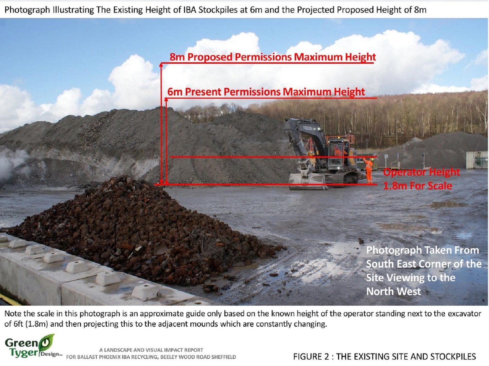


Analysis of Stockpile Heights
Green Tyger Design were appointed to provide an assessment of the potential visual impact on the surrounding valley of increasing stockpiles heights from 6m to 8m at this IBA (incinerated bottom ash) storage yard near Sheffield.
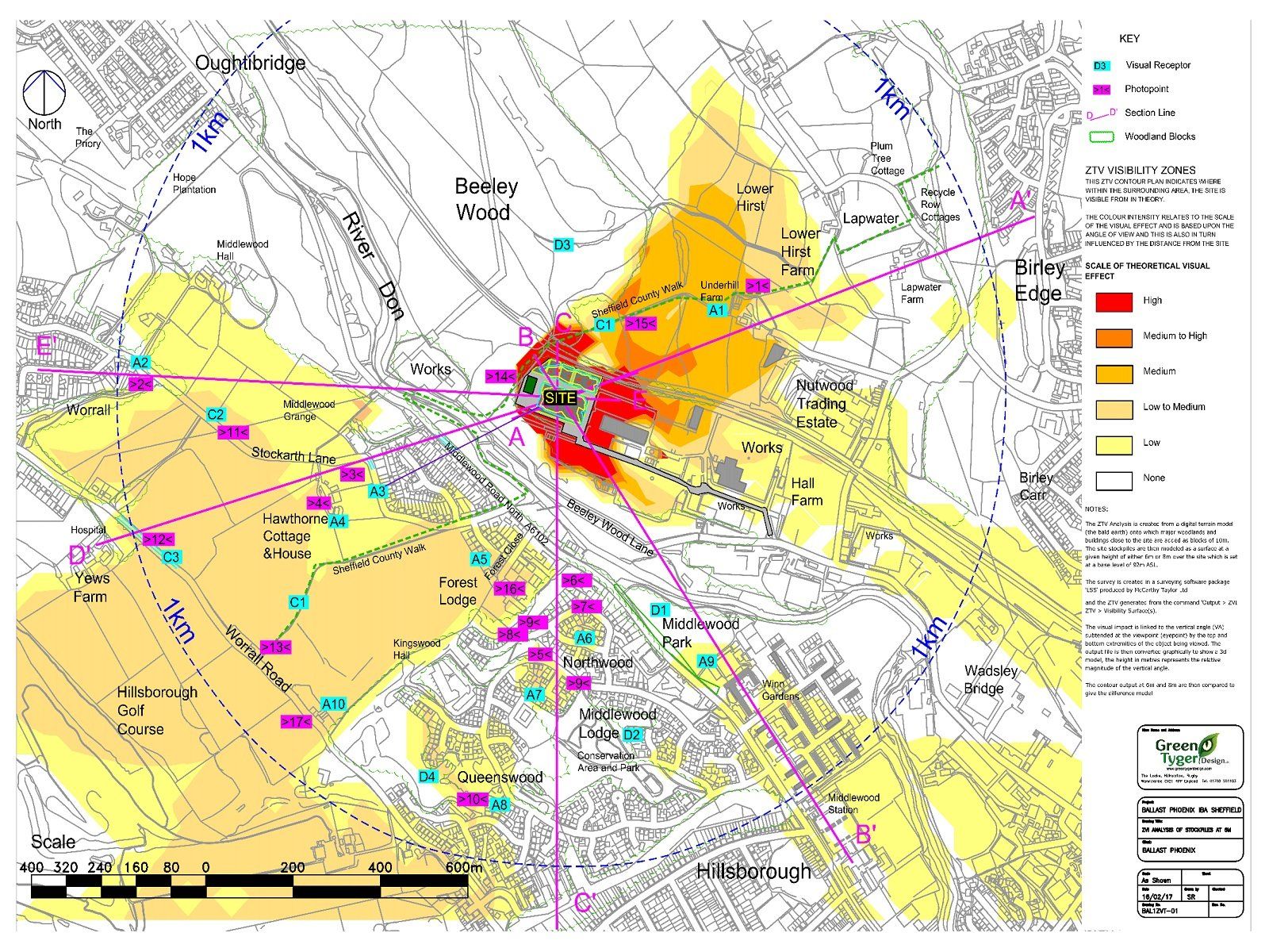
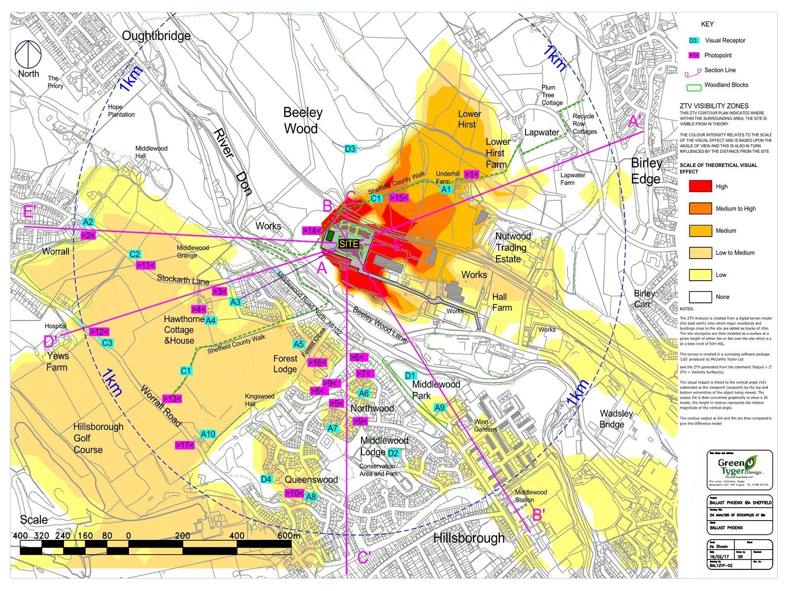
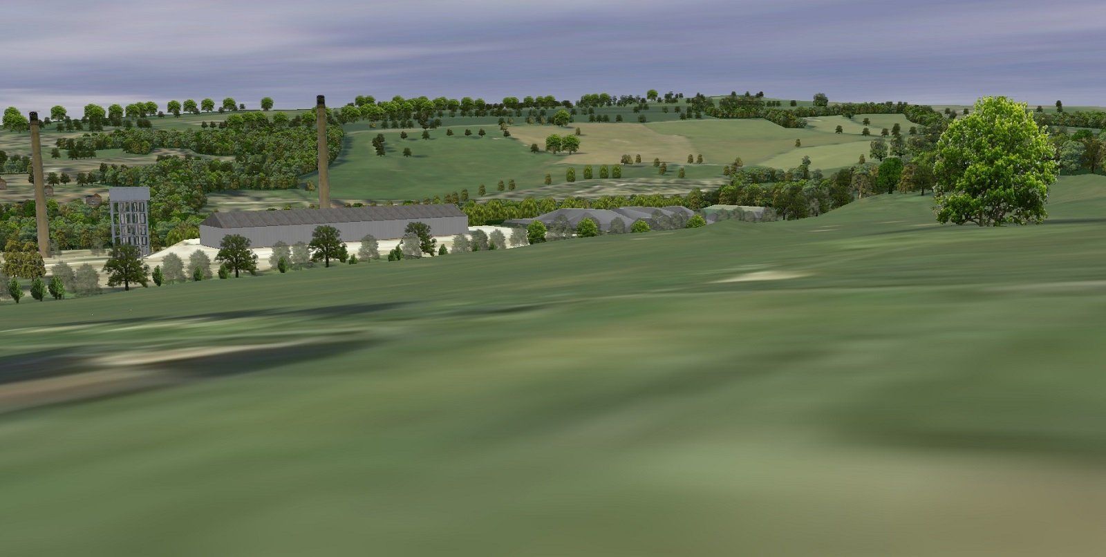
To compare the visual impact of stockpiles at 6m and 8m a ZTV (Zones of Theoretical Visual Influence) Analysis was undertaken with the surrounding valley modelled in 3D to understand the visibility of stockpiles at 6m versus 8m.
By producing a detailed report, with a series of visual maps and 3d model views the Local Planning Authority were able to grant the amendment to the current planning consent and allowed the storage yard to increase throughput from 135,000 to 200,000 tonnes of ash per year.
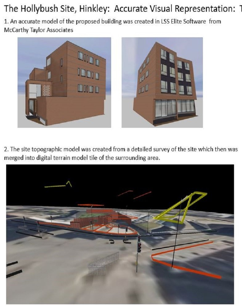
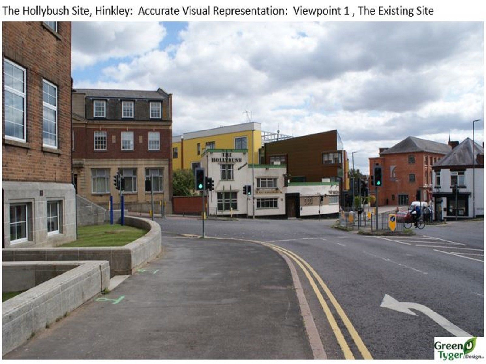
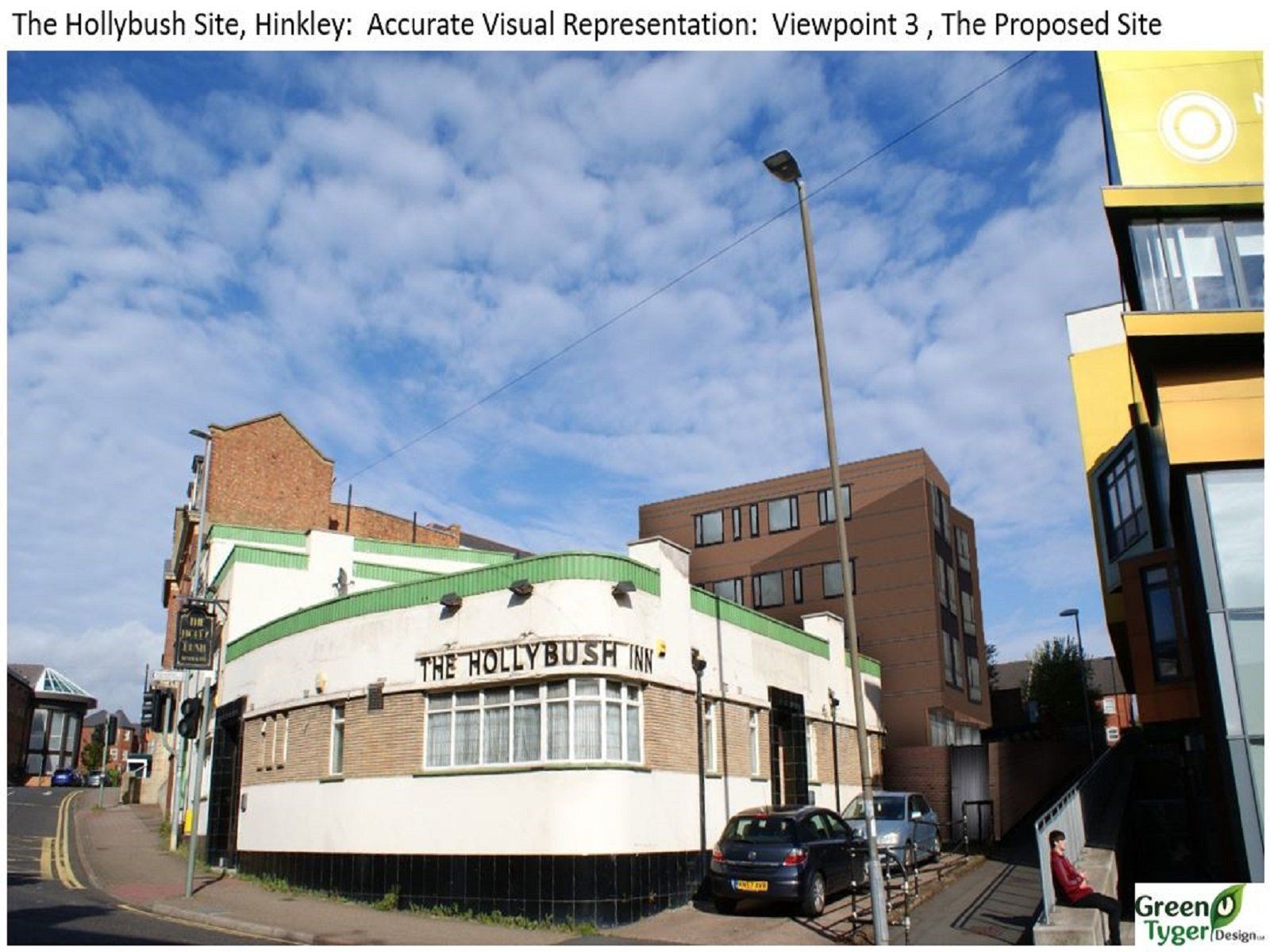
AVR For Residential Flats & Offices
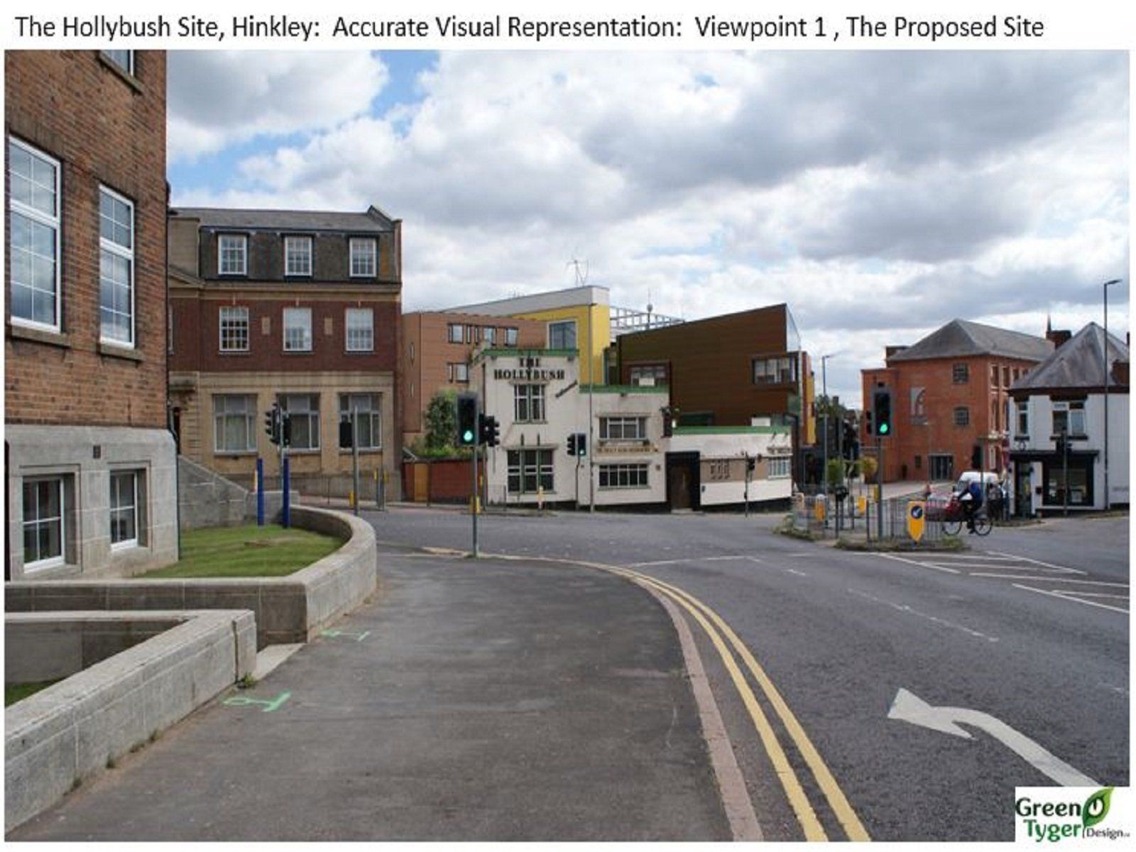
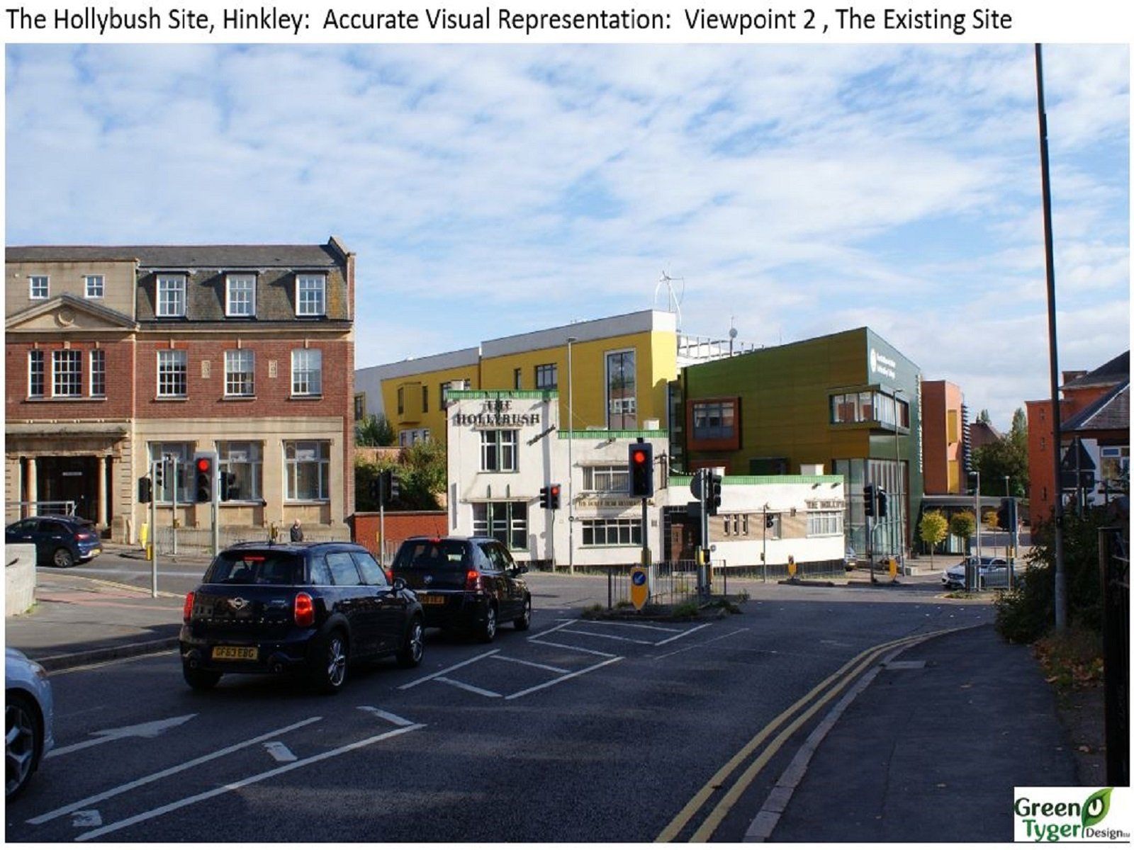
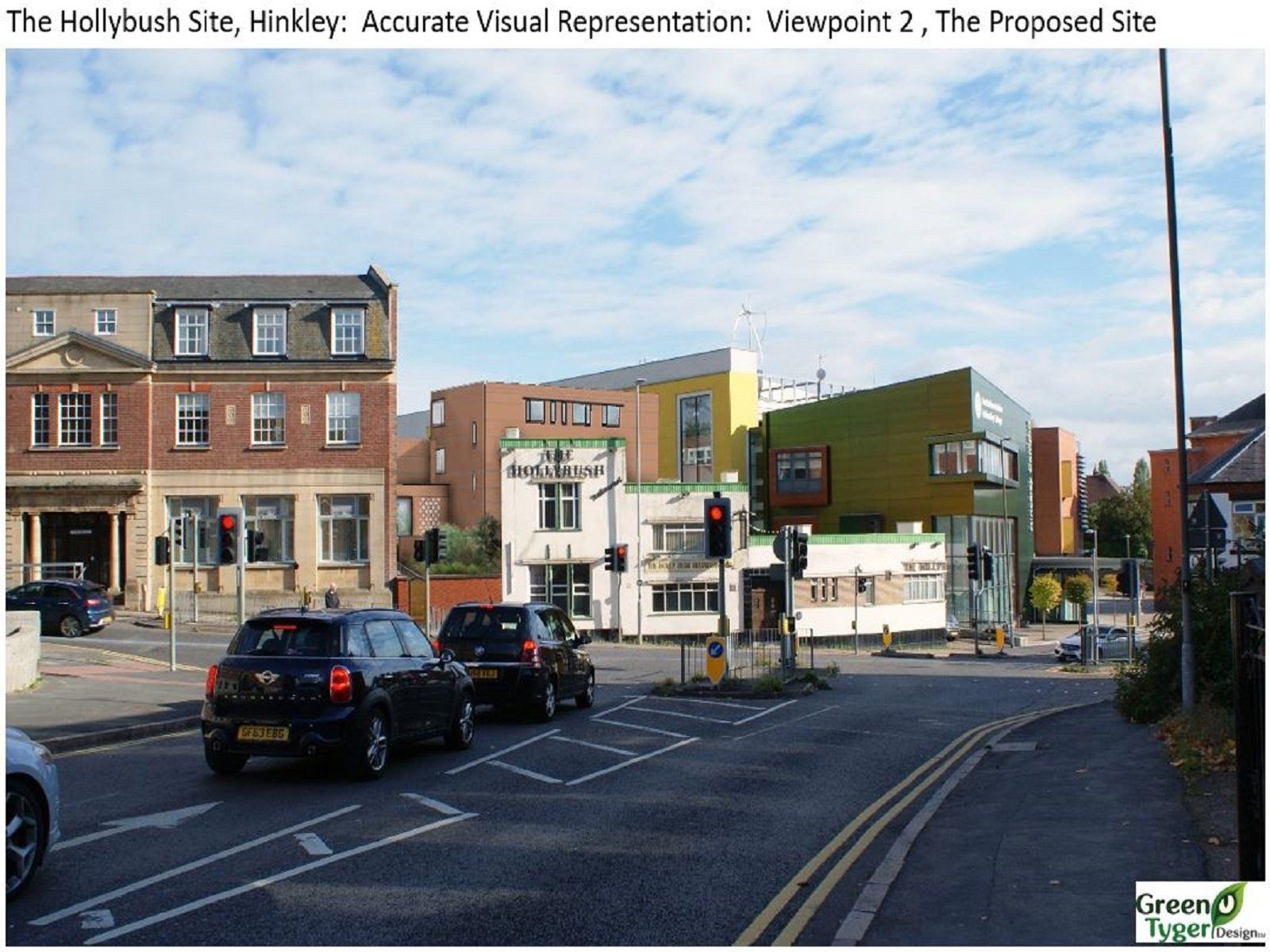
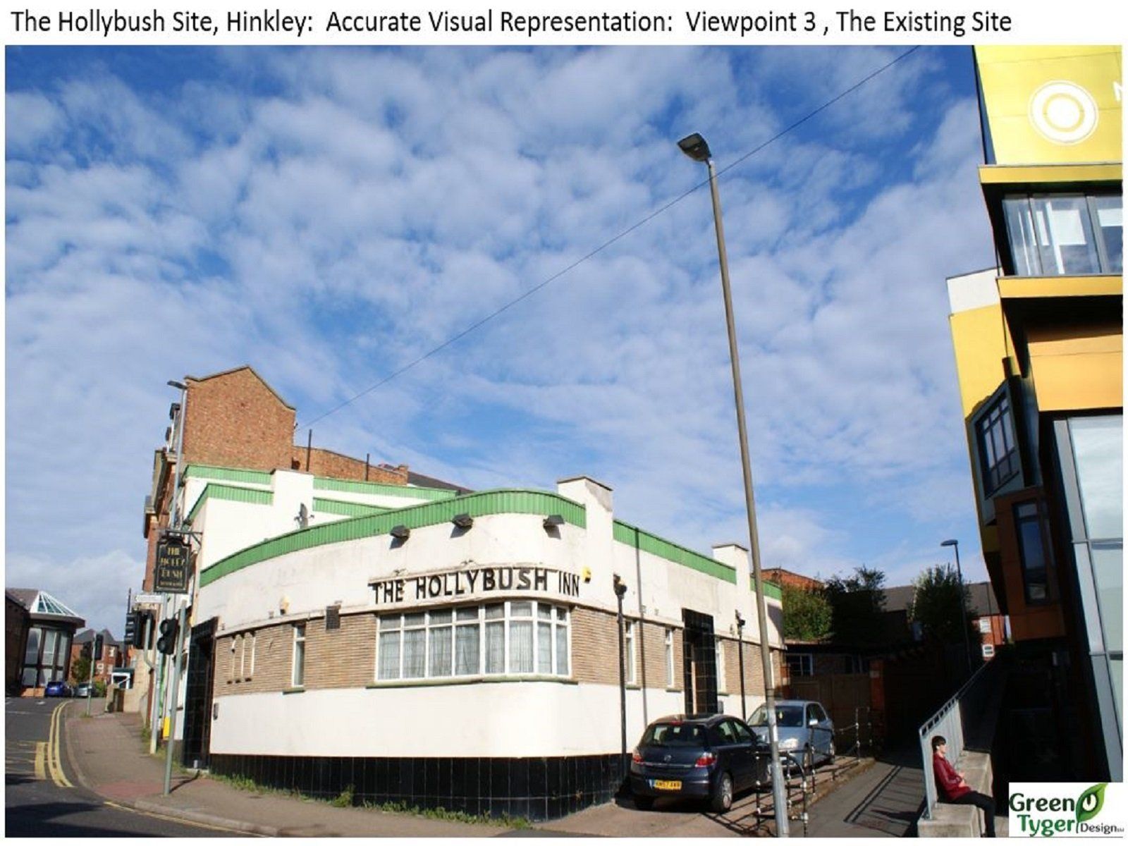
Green Tyger Design created this Accurate Visual Representation or AVR for a proposed residential block within the curtilage of a former public house in Hinkley Town Centre as part of a planning application.
The proposed new building designed by the Architect Duncan Mulholland was re-created in our 3D LSS Programme to scale within an accurate topographical survey of the area and surrounding buildings.
Photographs we taken of the existing site, without the new building and then another 'snapshot' was taken from the same location as the photograph within the model. The two images were then superimposed upon one another to show how the building would appear from three viewpoints on the main road junction.
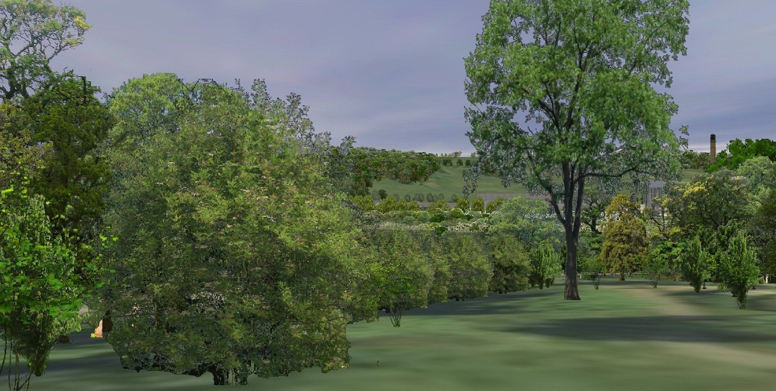
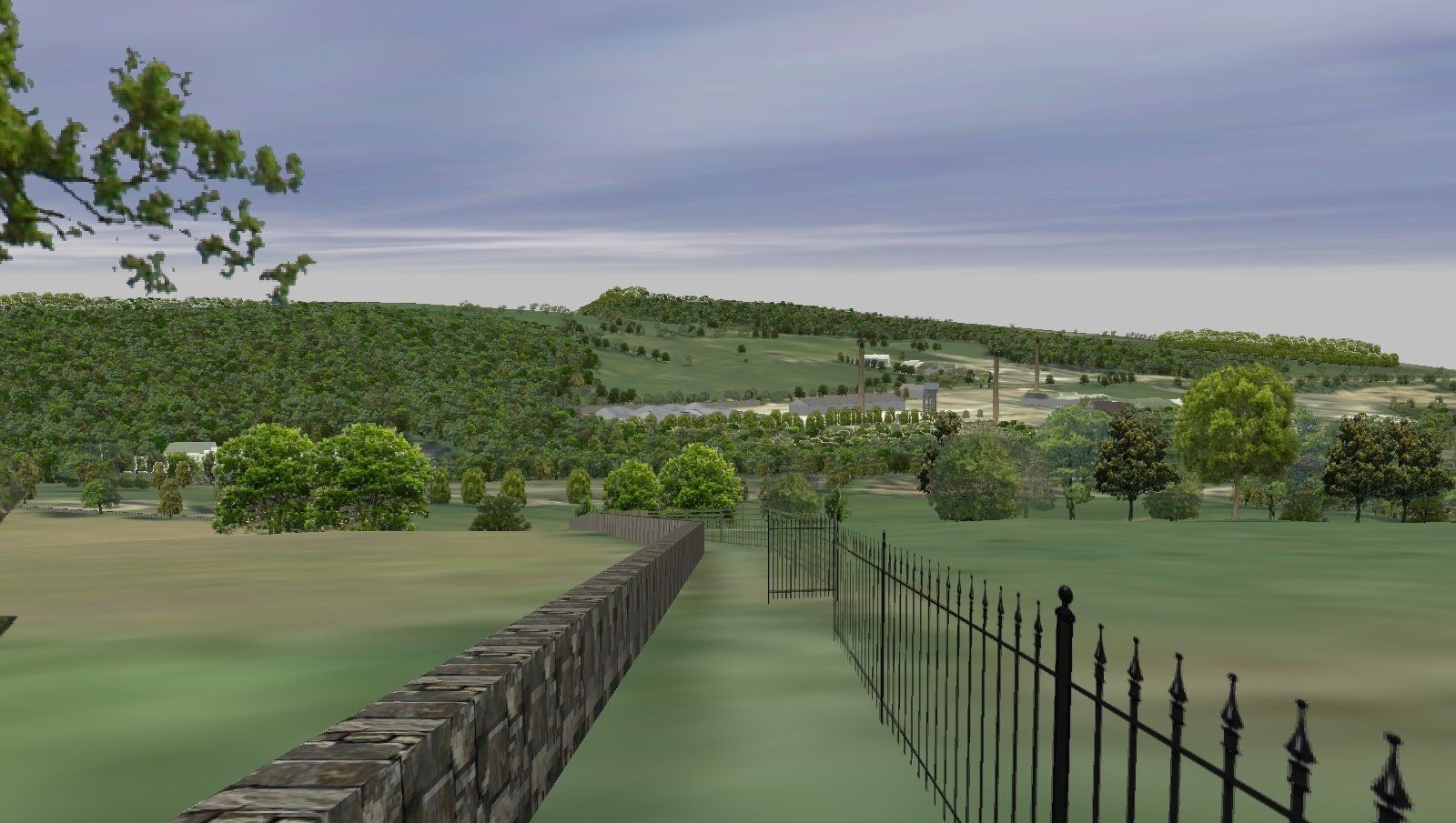
3D Model of a Biogas Plant
Green Tyger Design created a 3D model of a proposed Biogas Plant in Warwickshire together with up to 2km radius of the surrounding area in order that the planning authorities could understand how the new recycling facility would appear to any potential landscape receptors in the locality and particularly from a nearby village.
The new tanks and sheds are to be contained within a large earth bund recycled from the site ground excavations and planted with native trees and shrubs to blend in with the surrounding landscape and screen the proposed structures.
This type of visualisation can help the planners, public and client to understand how the development will fit in with the wider surrounding landscape and helps to fast-track the application through the planning process, meaning that the plant can become operational sooner.