Landscape & Visual Impact Assessments
Visual impacts on the landscape LVIA and ZTVs
Landscape and Visual Impact Assessments are detailed studies prepared by qualified landscape architects following guidelines published by the Landscape Institute to assess the potential impact of a new development within a defined area, known as the visual envelope. This report is often a requirement as part of a planning submission for developments in the UK.
To ensure the report is as impartial and objective as possible, we use the latest computer 3D modelling to give the best chance of gaining planning consent with the right mitigation measures in response to any significant visual impacts identified.
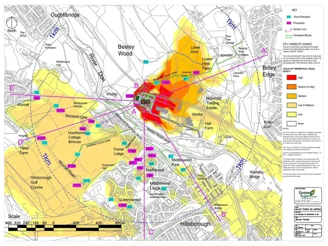
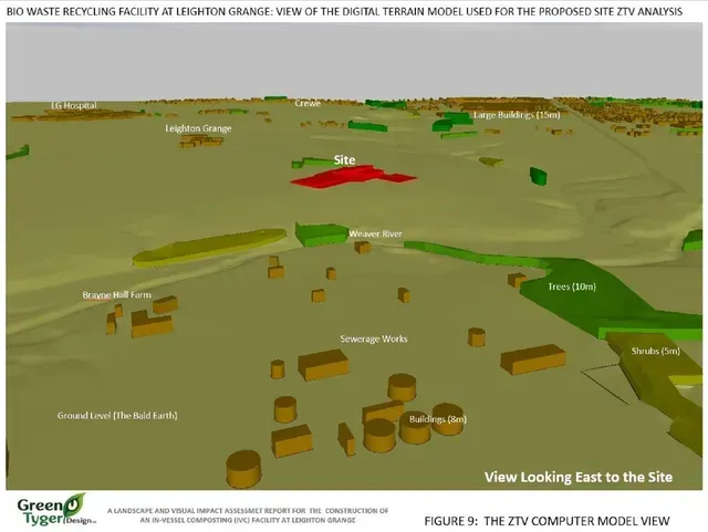
To do this our large scale 3D models can map out the Zone of 'Theoretical' Visual Influence also known as ZVIs or ZTVs for any development. By mapping the areas which can see the existing site before development and those which can see the site after development, we can objectively demonstrate the changes both in magnitude and extent of the potential visual impact.
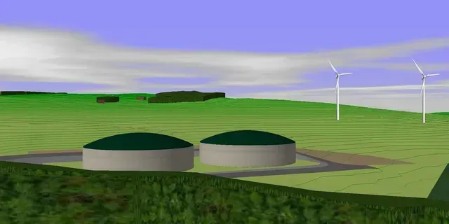
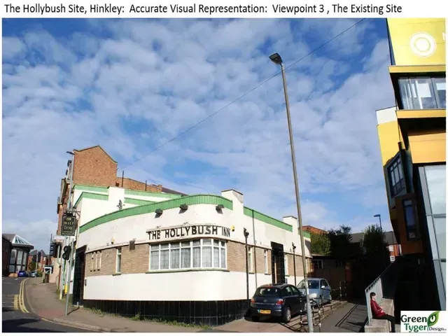
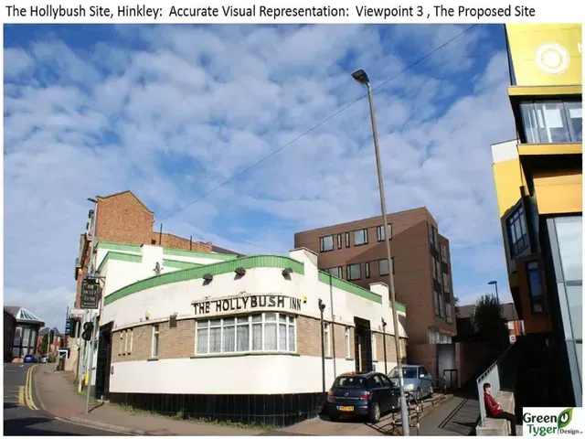
Accurate Visual Representations (AVR)
Whether it is a change of ground level, raising a stockpile or a new building development we can assess the visual impact within the surrounding area and can back this up with Accurate Visual Representations AVRs which can help the Planning Authority to understand for themselves the potential changes in the views brought about by the development.
By preparing these detailed models and researching the existing landscape character, we can prepare the landscape design to mitigate any significant visual impacts and therefore avoid any reasonable objection on these grounds by the scheme objectors or the Local Planning Authority.