Environmental Surveys
Arboriculture, Archaeology, Topography, Cultural Heritage, Ecology and Environmental Surveys...
In any large development, the planning authority will often require a range of specialist environmental surveys in addition to the Landscape and Visual Impact Assessment and a number of these can be carried out by our associate consultants.
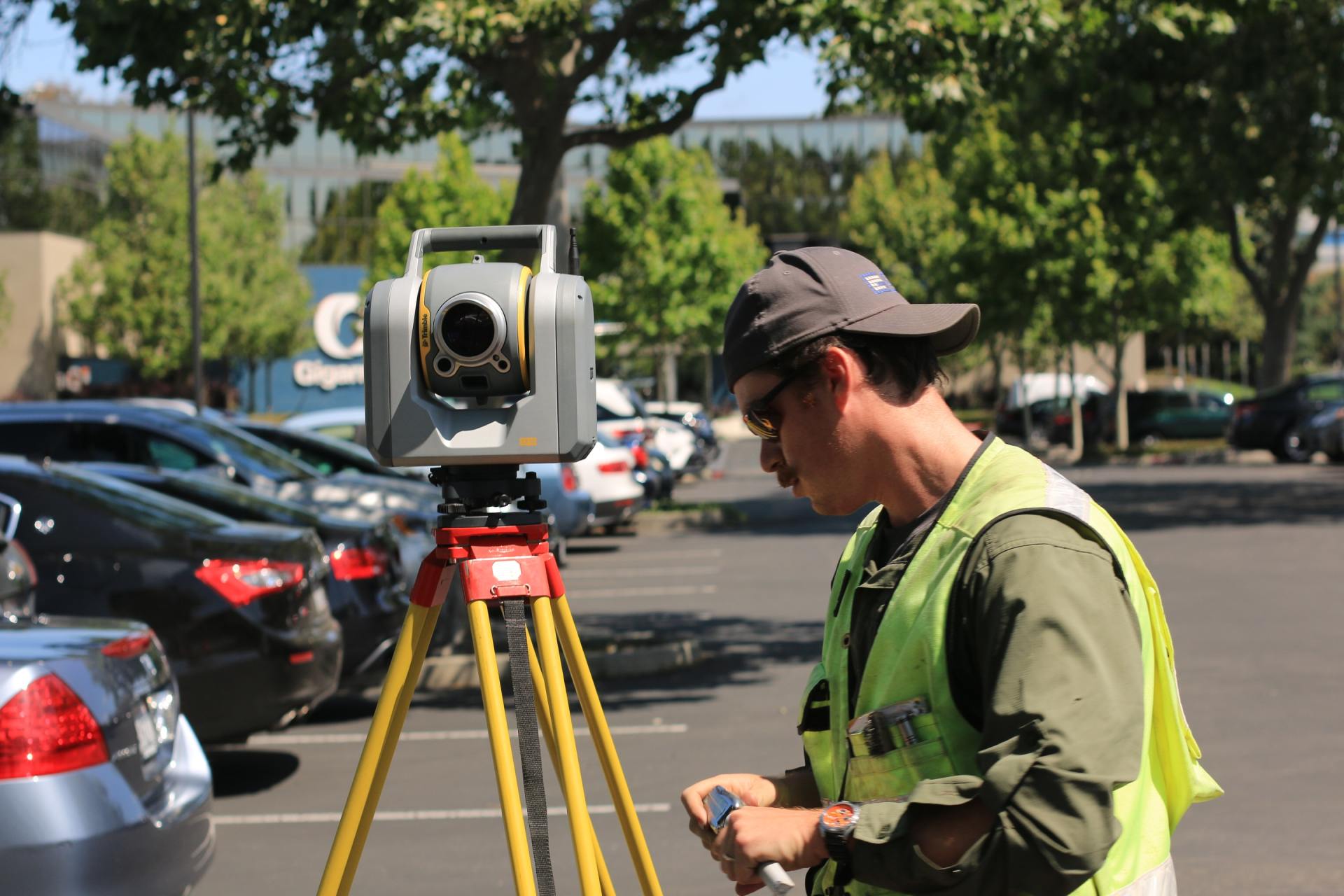
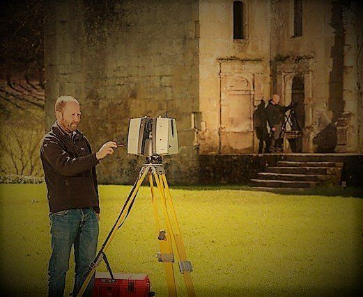
Landscape and Topographic Surveys
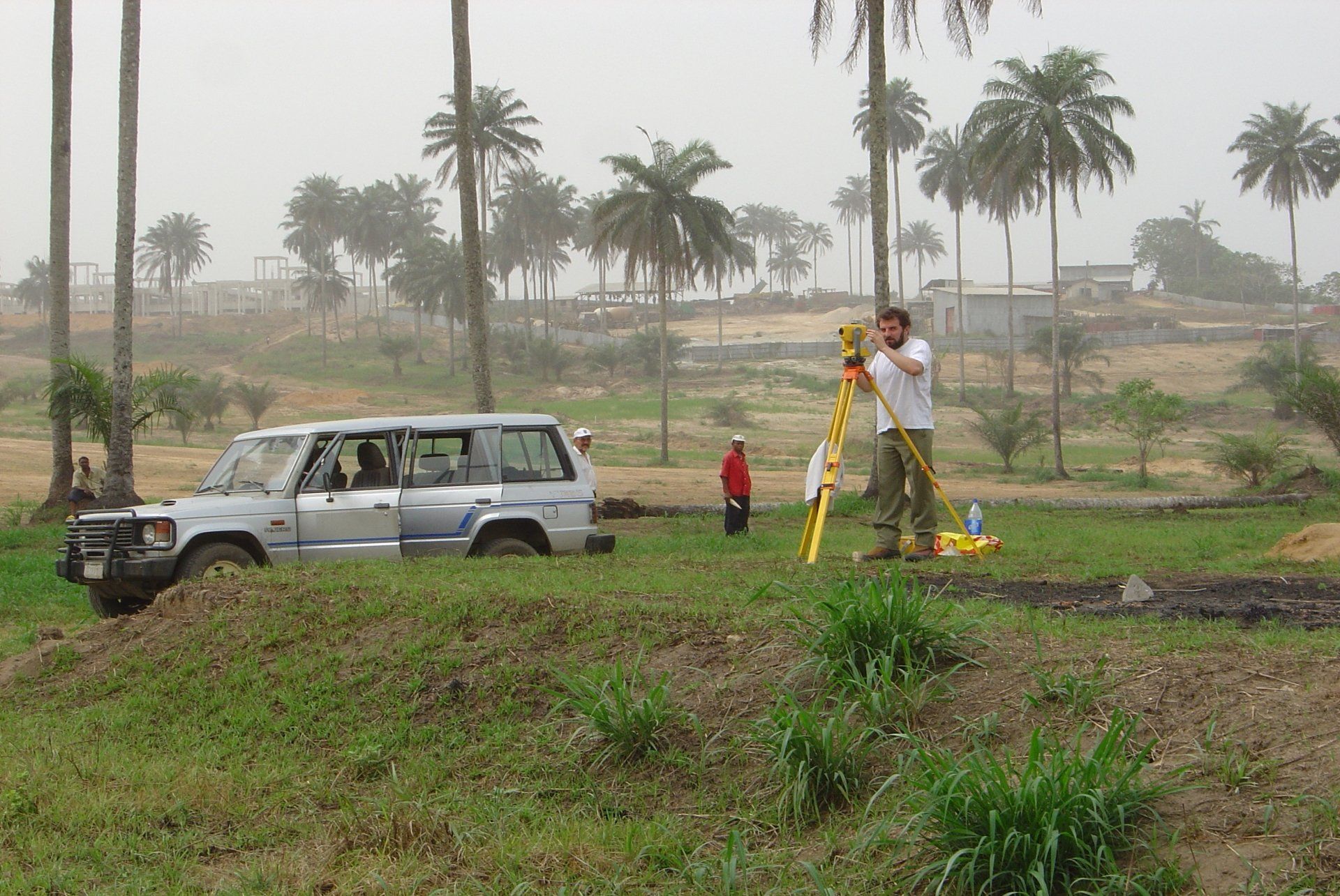
It is very important when dealing with a large site to carry out a thorough and accurate topographic survey to show the existing site.
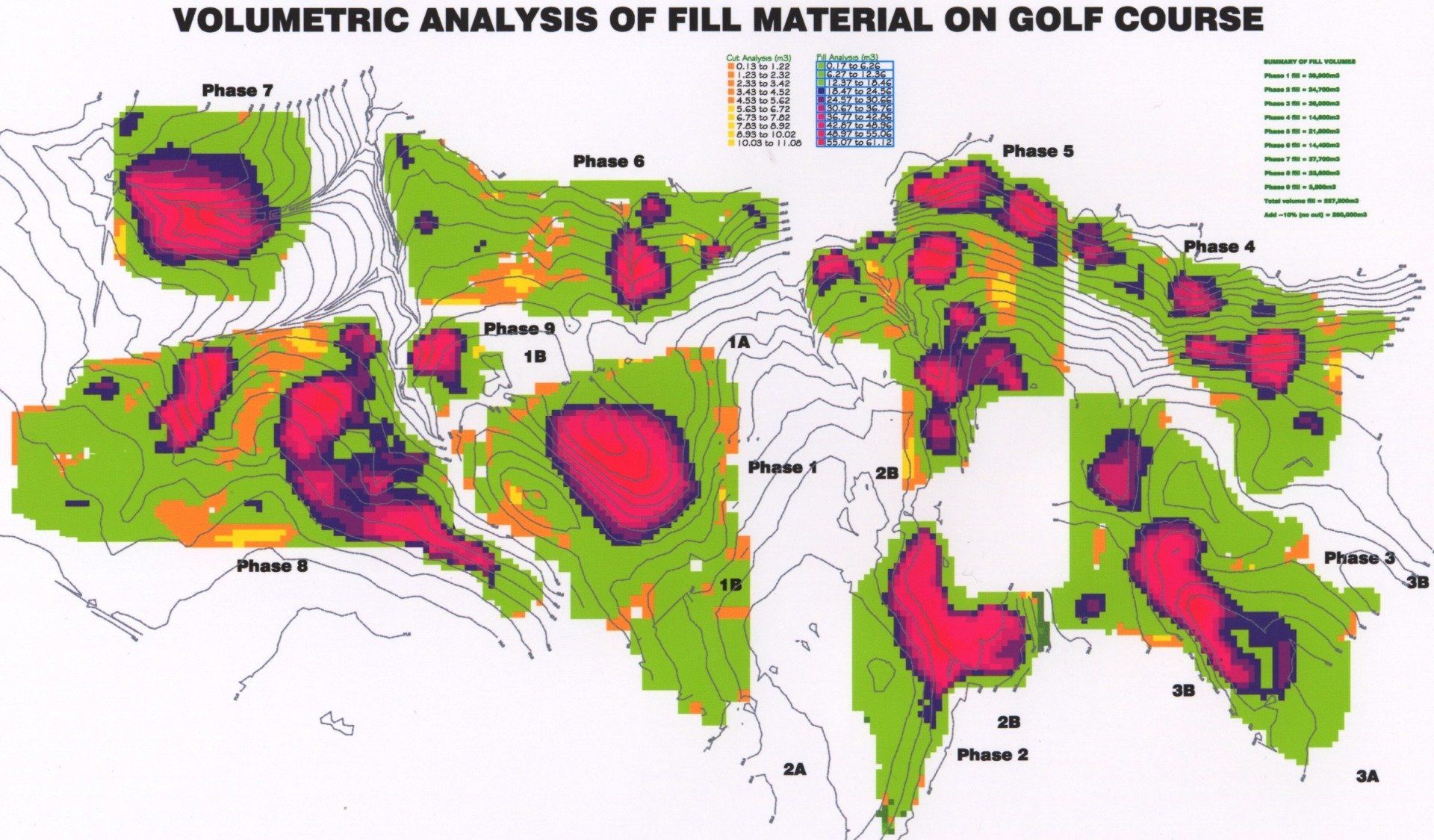
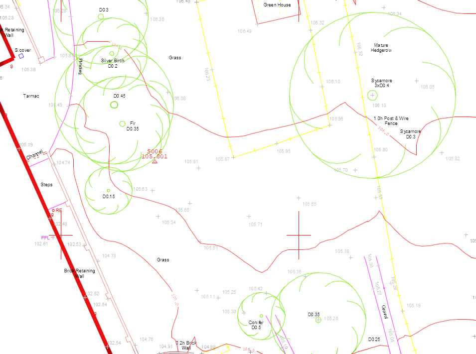
The topographic surveys are carried out by our expert surveyors and include land levels (contouring) existing overground features such as trees, buildings, roads and furniture but can also include underground features such as services if required and are plotted as AutoCAD or 3D Survey Computer Models.
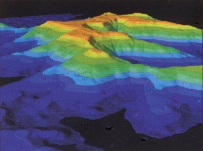
We can also carry out a range of other surveys using drones to create 3D Models of buildings or structures within the landscape and even Laser scans (LIDAR) to build complex 3D point clouds of large sites such as quarries, mountains, coastlines, golf courses or cave structures beneath the ground.
Environmental Services
We have partnered with Crestwood Environmental Ltd. to provide a range of environmental survey, planning, assessment, management and monitoring services, including those relating to:
- Archaeology and Cultural Heritage
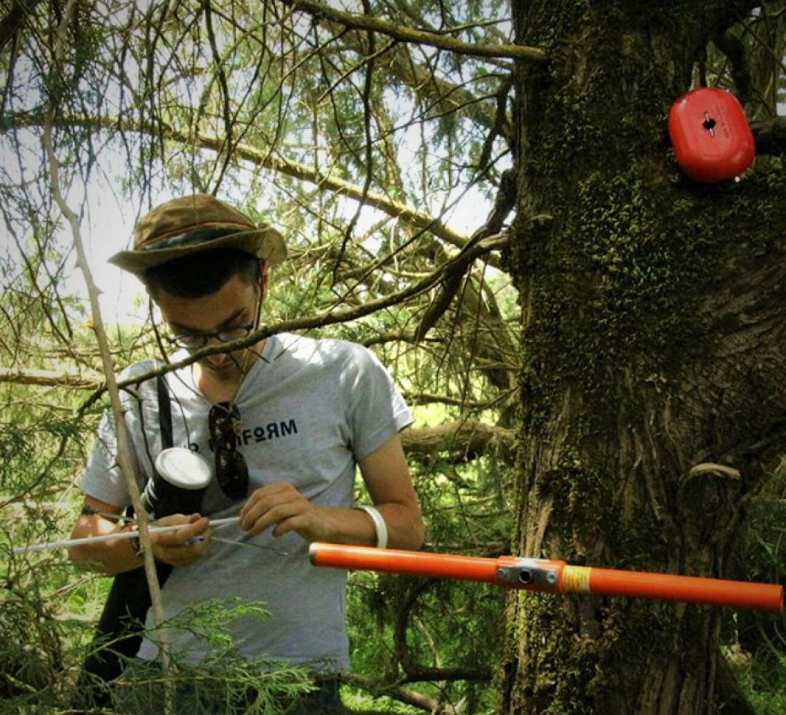
- Arboriculture
- Air Quality, Dust and Odour
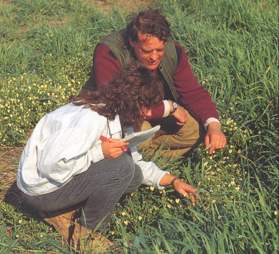
- Ecology and Biodiversity
- Lighting
- Noise
- Soils and Ground Conditions
- Waste and Resource Management
- Water (quantity and quality management)
Above is a short list but for a full range of services, please visit the Crestwood Environmental website by clicking on the link here.